Smart City
Transportation systems, urban safety, integrated solutions for urban environment, tourism, education, healthcare, and sports
use scroll
Сities are growing smarter, and are thus becoming more livable and responsive. Today, we are only witnessing the beginning of what technology is capable of in an urban setting.
With our ready-to-use ERS services, turnkey data receiving stations, UAVs and own small satellites, including onboard instruments, you can reach outstanding results, improving your operations in various areas: environmental monitoring, construction and urban development, transport and maritime navigation, meteorology or education.
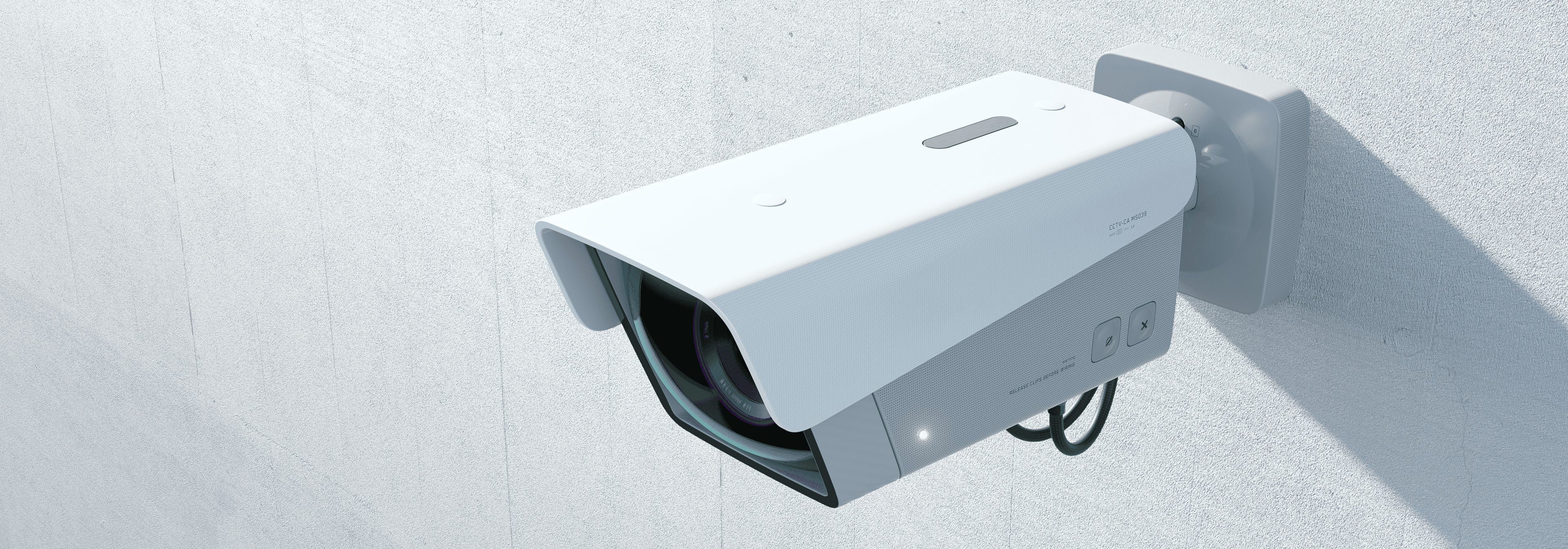
Advanced Video Analytics
Video surveillance is already widely employed in public and business safety. To get more out of standard systems, we can supplement this infrastructure with our unique software solutions.
We deliver best-in-class solutions for integrated geophysical 3D seabed mapping based on elaborate hydroacoustic and information technologies, allowing for faster, higher-quality, and more detailed hydrographic and geophysical surveys at a lower cost than traditional tools.
With 120+ neural networks on board and a wide range of video inputs, we provide a no-code/low-code deep learning video analysis platform that tracks people, detects activities, and recognises objects in real-time.
AI-based video analytics reduces the strain of repetitive and time-consuming human video observation duties. AI can not only monitor data but also be trained to use enormous amounts of video footage to recognise, identify, categorise, and tag specific items. AI-powered video analytics systems extract useful information from videos of various formats by using progressive CV (Computer Vision) and machine learning methods.
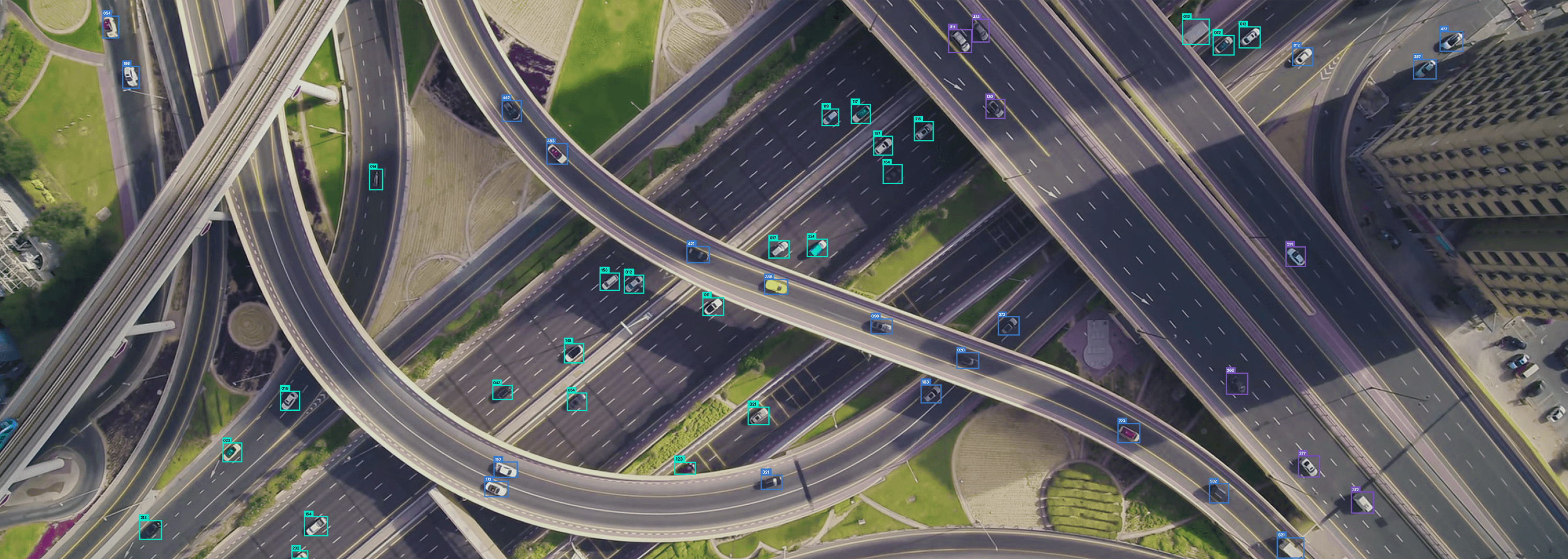
Intelligent Transport Systems
Intelligent transport system implementation generates new value and income for government customers.
We provide an array of digital platforms and digital products that may be used to build intelligent transport systems in cities and towns of any scale, resulting in fewer road incidents, improved citizen mobility, and increased road infrastructure utilisation.
These systems include, among other things, solutions such as digital traffic lights, road controllers and traffic detectors, weight and size control in motion, smart bus stops, and smart intersections.
Our Solution Highlights
- UP TO%
30
Less accidents
due to improved traffic and transit control
- UP TO%
30
Less transport time
and boosting your eco-friendliness

Digital Twins
Digital twins enable you to analyse and optimise your processes in such areas as transportation, energy consumption, HVAC and heating, water supply, and others.
We offer an innovative Big Data cloud-based platform aimed at achieving and maintaining high-performance operations and efficiency in a variety of applications ranging from smart buildings to smart traffic lights.
This solution enables you to construct a digital twin of any object by collecting Big Data, creating a digital footprint of operations for analysis and reporting through data visualisation, and collecting data from multiple utility systems. It enables simple, cost-effective, and non-intrusive gathering of data in any new or existing setting, as well as prompt identification of issues by applying big data operations patterns and machine learning algorithms.
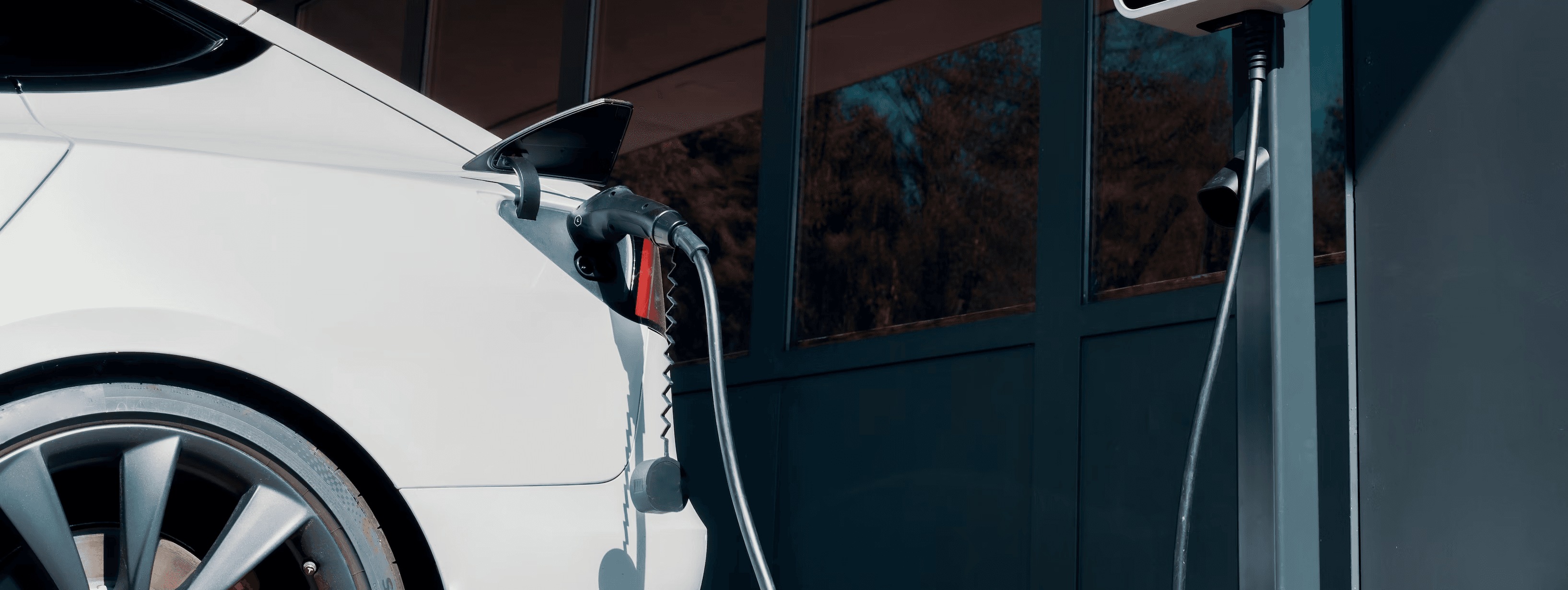
Green Solutions
Green technologies not only promote sustainable urban development by creating a healthier environment, but also give long-term economic benefits.
We offer green transport solutions that not only comply with decarbonisation and sustainability policies, but also generate fresh cash for the city budget and even serve as a decorative element in today's urban landscape.
These are ultra-fast charging stations with varying capacity, a digital platform for in-house monitoring and control, and a client mobile application. Furthermore, these are noiseless, pleasant city electric vessels with cutting-edge design developed on their own serial platform. They include totally electric waterbuses for year-round navigation, coastal-use catamarans for walking and transporting passengers, and high-speed river-sea boats.
Another alternative for making cities greener is a modern digital platform for monitoring municipal solid waste removal, with an in-house system for controlling solid waste export. Based on IoT technologies, real-time tank status control and data transmission capabilities over NB IoT ISP network.
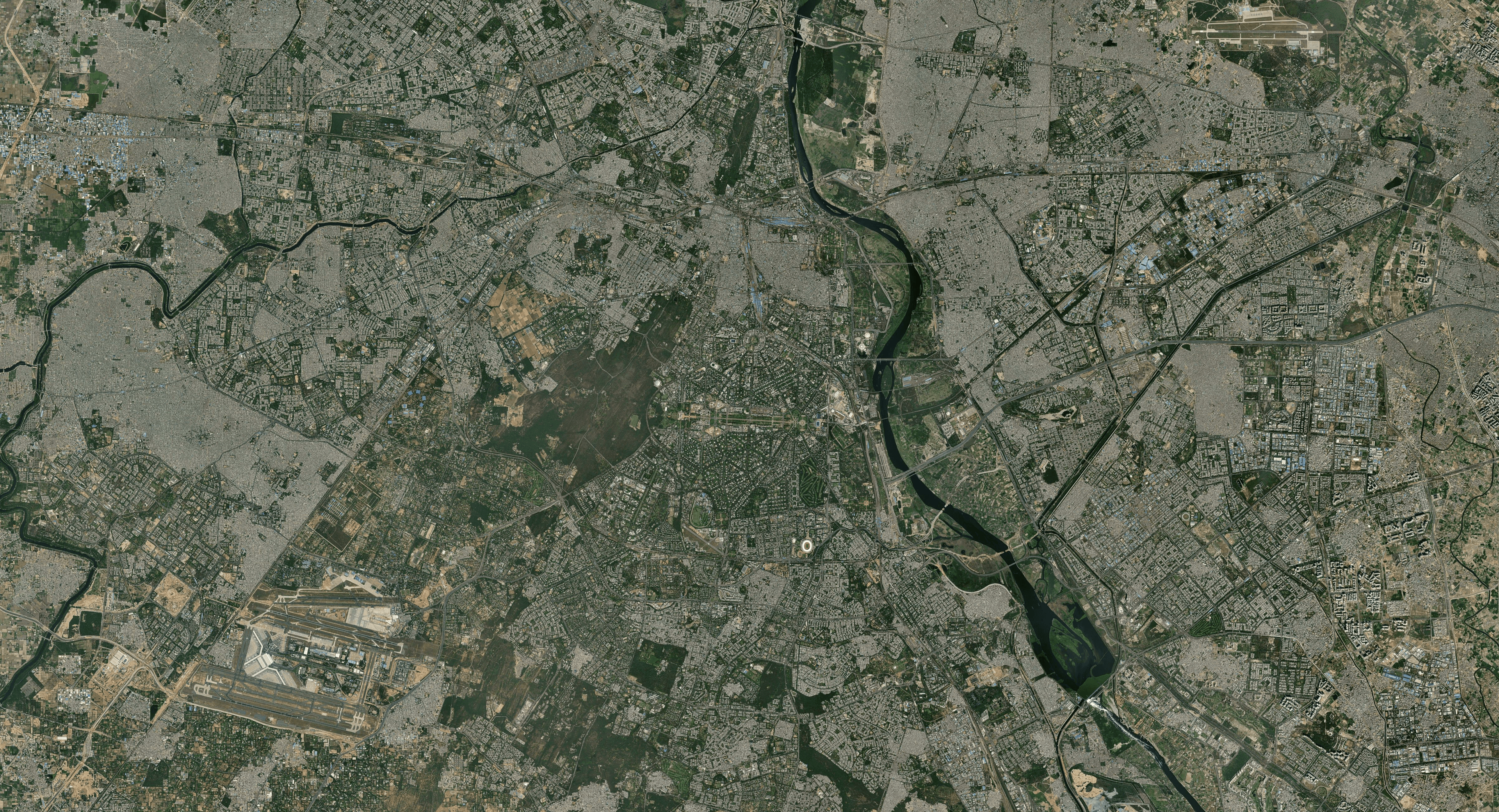
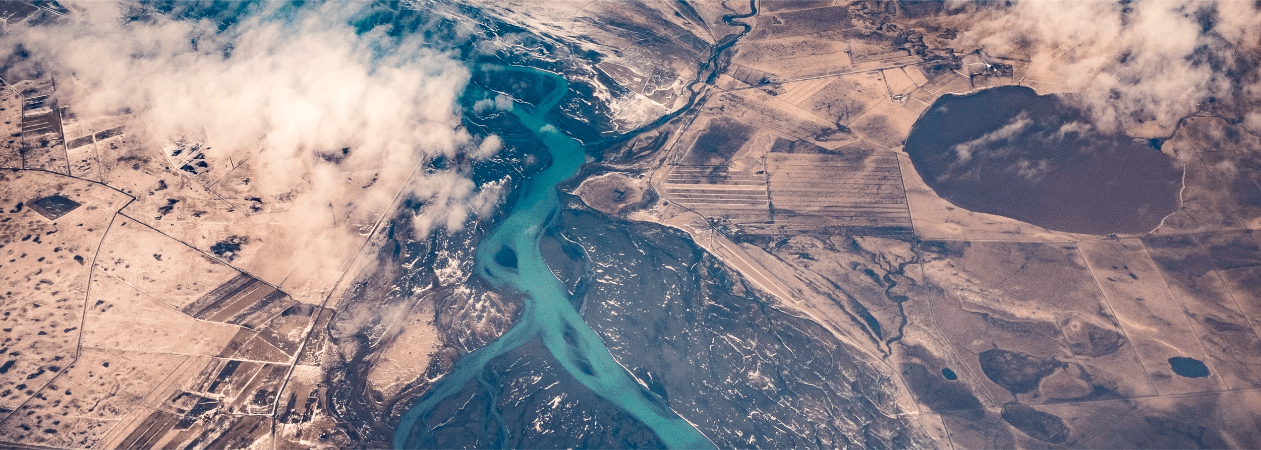
Remote Sensing
Earth Remote Sensing is the most cost-effective technology for monitoring large urban areas for a various purposes.
Our technology allows us to investigate the Earth's surface using data from satellites and drones.
We provide ready-to-use data services, such as our own mathematical models, historical and analytical data sets, and software that allows you to create your own independent services for an array of industries, including environmental monitoring, land/cadaster management, construction, agriculture, meteorology, and education.
Drone Port platform is another solution for city monitoring: completely automatic take-off and landing station with drone operated 24x7, adjustable frequency of drone flights - on demand or on a predetermined schedule capable of automatic task execution.
It is prepared for many user scenarios such as constriction monitoring, changes in the urban environment, ecology, transportation infrastructure, object security, police tasks, etc. It allows you use drones as a service to boost drone time utilisation, improve their usage for monitoring services, and make significant cost savings when compared to the conventional approach, all while enhancing the safety of flying drones in cities.
Environmental Monitoring
The comfort of the city and its inhabitants directly depends on the state of the environment. We offer advanced solutions for remote and contact monitoring of the state of the environment.
Our remote sensing solutions include weather and environmental analytics, as well as the ability to detect pollution cases, polluted areas, potential sources of pollution, and determine likely routes of pollution transfer.
The latest air quality monitoring network offers real-time analytics, forecasting, and digital services for mapping air pollution.
The platform has trajectory tool for pollution dispersion modelling, dynamic hyperlocal street-scale QA forecast, and tolls for dynamic air quality forecast.
Measuring Capacity of Ambient Air Pollutants
PM2.5
H2S
PM10
CO
NO2
O3
SO2
next section
Infocom